Photo by Robin Betz
The day before we left Gracias, Jessie was busy directing our mechanic with her new found spanish vocabulary, Laura was on point wrapping up our Jungle Fashion photo shoot at the hotsprings, so I set out for one more scouting mission while we were there. I took a picture of this coffee stained topo map to guide me and grabbed a bus ride about 45 minutes south of Gracias to the small and 'quaint' little town of La Campa. You can see the steep gorge walls and a pretty good gradient on the map but that tells you nothing about the composition of river bed.
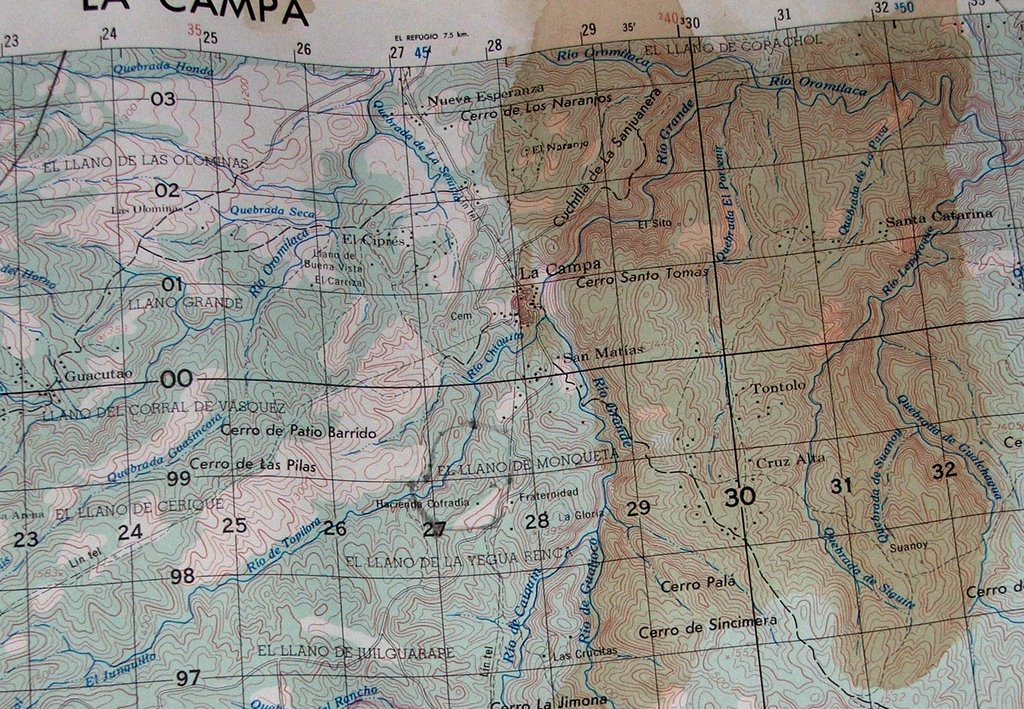
Photo by Robin Betz
After jumping off the bus I looked up and saw the skyscraper gorge walls that must be the beginning of the river I wanted to scout which flowed north east away from town.

Photo by Robin Betz
I started hiking downhill toward the river, and as the river gave way, even though it was too low, I noticed a healthy high water mark indicated about 10 feet above the river bed by coke and pepsi bottle eddy trash and debris in the riparian shrubbery. It was disappointing to realize, based on the amount of trash in the river, the people here must not realize that the rainwater and trash flows to from their streets...and into this beautiful gorge right next door. But as I rock hopped and bouldered my way downstream I realized that there were 3 basic criteria that must be met to some degree, which would satisfy our definition of a "runnable creek" These criteria are the following.
1) there must be a healthy flow of water
2) there must be a gradient of at leat 80 fpm, hopefully more
3) there must be a 'clean' or well-channelized river bed.
We all know that the Sierra Mountains in California have some of the best creeks in the world because of the great combination of these three criteria, 1) predictable river levels in a snow-melt environment, 2) sicko gradient, young mountains dropping fast into the ocean, and 3) Granite bedrock, enough said.
Well here in Honduras, things are not quite as straight forward, but I like this next picture because it says alot about what we found, and makes me think...is this Honduras or West Virginia?
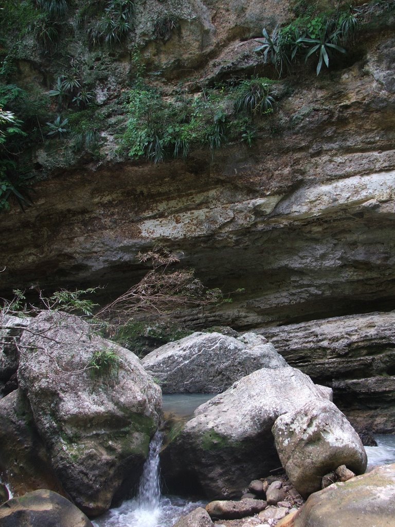
Photo by Robin Betz
1) the river levels here are rain dependant, and even though it rained everyday and were in the quasi rainy-season, we needed a rainier season, or a tropical storm event because all the water was getting sucked up by the surrounding lush vegetation.
2) no problem here finding gradient, but we still had to be careful that we were looking for gradient that had at least 10-15 miles of stream contributing to that section.
3) most of the creeks we found were much like the south east dominated by tbe boulder garden type rapid, however in this creek I found a strange type of bedrock that created some strange pothole features and narrow slots.
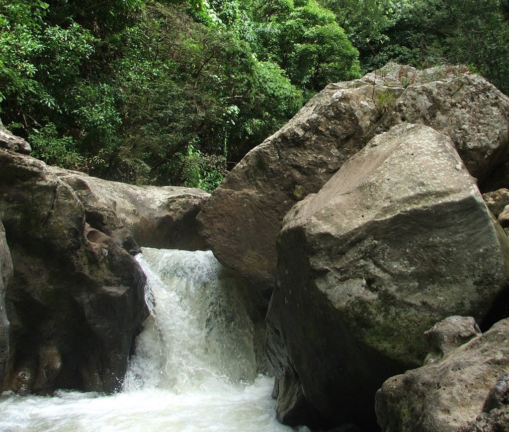
Photo by Robin Betz
Even though the walls were super steep, the gorge contained a healthy river bed in which I could rock hop and scramble down stream for roughly 2 km until the confluence as you can see on the map. At this point I realized I would need a machete and a set of climbing ropes in order to continue downstream, or maybe a rainstorm and a kayak for next time. So, I hiked out via the ridge and here is the view of the river below.

photo by Robin Betz
Sometimes it was disappointing finding rivers but no water, but we realized that this is what happens to all explorers; nothing ever goes as planned, travel takes three times longer than expected, and you end up finding something totally different than what you set out searching for. But someone has to go check it out, or else you'd never know. I think that more time is needed to fully investigate the whitewater potential in Honduras. I think that we were merely beginning to scratch the surface as our time ran out. Next time I would like to go in November, during the full-on rainy season, and ideally we would have a helicopter, or at least a set mules and a personal trail cutter, since road access made things quite difficult here.
At this point with about a week left we decided to check out the rivers in the mountains surrounding the city of Tegucigalpa. At this point the rivers drop abruptly to the south and west toward the Pacific Ocean. Again we found some potential but had limited time to scope them fully. From there we took a quick trip to surf the coast of Nicaragua. Stay tuned for this final trip report...